Routes
Routes draw curved A→B lines that follow the great circle — the shortest path on a sphere. Use them for trade flows, supply chains, migration corridors, or any map that needs to show a connection between two places. Endpoints can be ISO country codes (resolved to centroids) or explicit lat,lon coordinates.
Examples
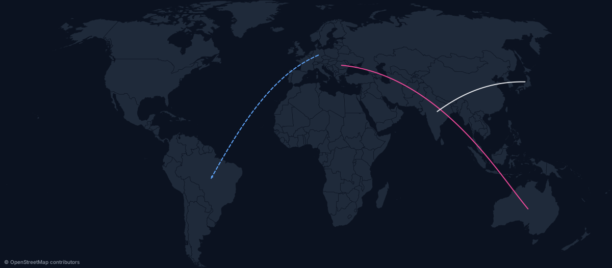
Three routes with mixed styles:
https://api.maproll.io/map.svg?scope=world&theme=dark&routes=DE%3EBR:%2360a5fa:2:dashed:arrow%3BRO%3EAU:%23ec4899:2%3BJP%3EIN
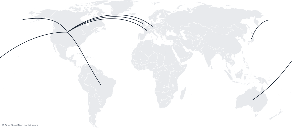
Hub-and-spoke: six routes radiating from the US:
https://api.maproll.io/map.svg?scope=world&theme=light&routes=US%3EGB:arrow%3BUS%3EFR:arrow%3BUS%3EDE:arrow%3BUS%3EJP:arrow%3BUS%3EAU:arrow%3BUS%3EBR:arrow
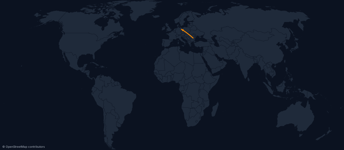
Literal lat/lon endpoints — useful when the destination is a city, not a country centroid:
https://api.maproll.io/map.svg?scope=world&theme=dark&routes=44.43,26.10%3E52.52,13.40:%23ff8c00:3:arrow
Routes with marker icons at each endpoint:
https://api.maproll.io/map.svg?scope=world&theme=dark&routes=DE%3EBR:arrow%3BUS%3ECN:dashed:arrow&markers=52.52,13.40:airport:Berlin%3B-23.55,-46.63:pin:S%C3%A3o+Paulo:bottom%3B38.90,-77.04:flag:Washington%3B39.90,116.40:star:Beijing:right

Parameters
| Param | Type | Default | Allowed | Notes |
|---|---|---|---|---|
routes | string | — | See URL syntax | Semicolon-separated route definitions |
color | string | theme text color | 6-digit hex #rrggbb | Must start with # |
width | number | 2 | 1–20 (px) | Integer stroke width |
style | string | solid | solid, dashed | |
arrow | flag | off | arrow (presence) | Terminal arrowhead at the destination |
URL syntax
routes=from>to[:options];from>to[:options];...
Options after the >to endpoint are type-distinguished — specify them in any order:
| Option | Detected by | Example |
|---|---|---|
| Color | Starts with # | #ff0000 |
| Width | All digits, 1–20 | 3 |
| Style | Literal solid or dashed | dashed |
| Arrow | Literal arrow | arrow |
Endpoints are either:
- ISO codes — case-insensitive, resolved to the country's geographic centroid. Example:
DE,US,RO-B(subnational). lat,lonliterals — a comma in the token signals a coordinate. Example:44.43,26.10. Mix ISO and coordinates freely:DE>44.43,26.10.
The > separator was chosen over - so subnational ISO codes like RO-AG or US-CA remain unambiguous.
URL-encode > as %3E, # as %23, and ; as %3B in query strings.
# Simple ISO pair
routes=RO%3EDE

# With color and width
routes=RO%3EDE:%23ff0000:3

# Dashed with arrow
routes=RO%3EDE:dashed:arrow

# Lat/lon literal endpoints
routes=44.43,26.10%3E52.52,13.40

# Multiple routes
routes=DE%3EBR:dashed%3BUS%3ECN:arrow
JSON body syntax
Use POST /render/map with routes: RouteInput[]. The fromLatLon/toLatLon fields accept [lat, lon] and override the ISO lookup:
{
  "scope": "world",
  "theme": "dark",
  "routes": [
    { "from": "RO", "to": "DE", "color": "#ff0000", "width": 3, "arrow": true },
    { "from": "US", "to": "CN", "style": "dashed" },
    { "from": "XX", "to": "YY", "fromLatLon": [44.43, 26.10], "toLatLon": [52.52, 13.40] }
  ]
}
Notes
- Great-circle curves. Routes are interpolated with 64 samples via
d3.geoInterpolate, giving a smooth arc at world scale. - Antimeridian split. When a great circle crosses the ±180° meridian (the date line), the renderer automatically splits it into two segments meeting at the map edges. No client-side handling needed.
- Routes draw below markers. Marker icons sit on top of route endpoints, so the line tip doesn't poke through the icon.
- Unknown ISO codes. If an endpoint can't be resolved to a feature in the current scope, the route is skipped and the pair is reported in the
X-Geo-Warnings: unknown-routes:A>Bresponse header. The render still returns 200. - Centroid vs. city position.
from=DEresolves to Germany's geographic centroid (central Germany), not Berlin. For routes that must connect city markers, pass explicitlat,lonliterals matching the marker's coordinates. - Limit: 500 routes per render. Exceeding this returns
400 invalid_routes. - No multi-stop routes. Workaround: pass
A>BandB>Cas separate routes. - Arrow markers are deduped by
(color, width). Twenty routes sharing a color and width share one SVG<marker>definition.
Related
- Markers — place icons at route endpoints
- Annotations — add hover text to regions along the route
GET /map.{svg,png}— full query parameter reference- POST /render/map — JSON body schema
- Supply-chain recipe — routes + markers + annotations together